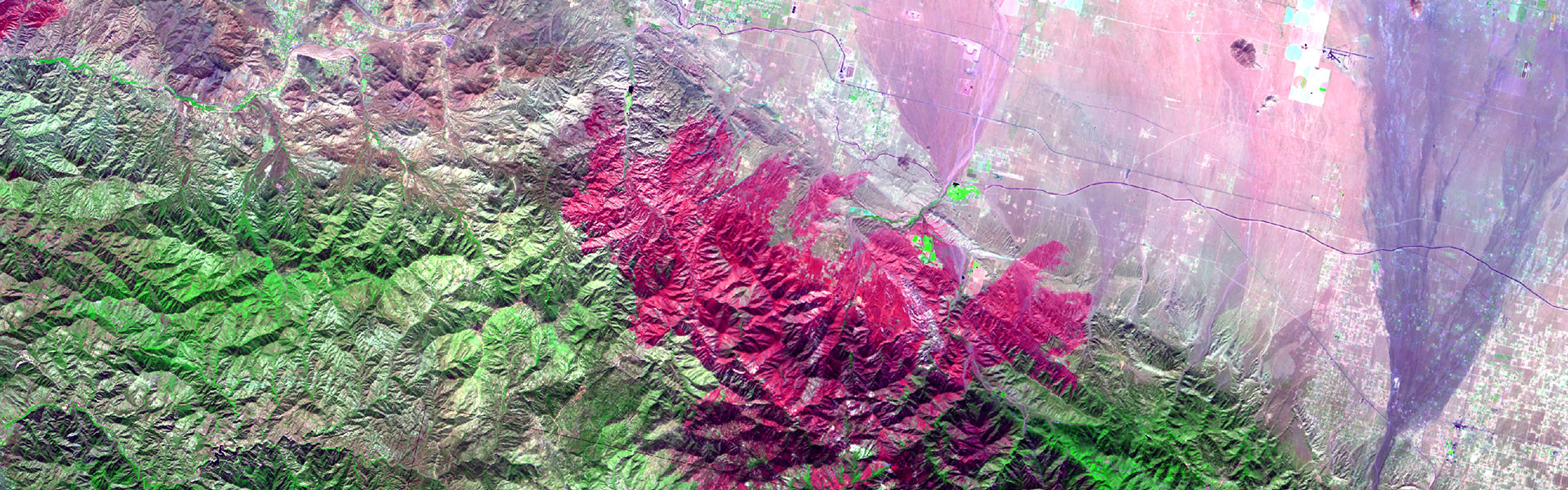
MTBS is an interagency program whose goal is to consistently map the burn severity and extent of large fires across all lands of the United States from 1984 to present. This includes all fires 1000 acres or greater in the western United States and 500 acres or greater in the eastern Unites States. The extent of coverage includes the continental U.S., Alaska, Hawaii and Puerto Rico.

Search Data
Via Interactive Viewer
Visualize MTBS burned area boundary and burn severity data as well as filter and download MTBS datasets....
Get Data
Via Direct Download
Select and download fire level and state/national MTBS datasets as well as access MTBS web map services....
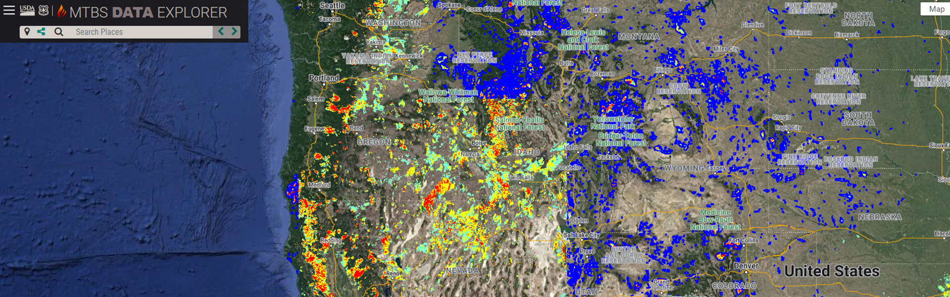
Analyze Data
Via Data Explorer
Dynamically view and explore MTBS data and conduct customized analyses and summaries....
Data Availability
Availability and Release Schedule
Access information on the anticipated release dates for new or revised MTBS data....