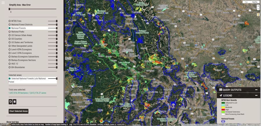
The MDE is a web app developed using GEE to provide users the ability to analyze MTBS data outside of a desktop GIS. Its visualization features allow users to easily explore the entire MTBS burn severity archive and calculate statistical summaries over a user-specified area of interest. The area of interest can be a region drawn directly into the interface or uploaded by the user in the form of a shapefile or geoJSON. Additionally, users can select and analyze data down to a single point (30m x 30m pixel) on the landscape, and download csv tables and graphical png charts based on their queries. For new users to the MDE, there is a tutorial available under the Support menu providing an overview of the available features and how to use them.
A recorded version of the MDE webinar is located here.
Please contact us with any questions or need for additional tool support.

Screenshot of the MTBS Data Explorer main user interface.