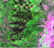
 Prefire scenes are comprised of Landsat TM/ETM+/OLI or Sentinel-2 MSI data and are selected to match the seasonality and phenology of the postfire image chosen. This layer is clipped to a 3km-buffered bounding box around the burn area boundary.
File Format: GeoTiff
File name: <Fire ID>_<prefire image date>_<sensor>_refl.tif
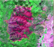 Postfire scenes are comprised of Landsat
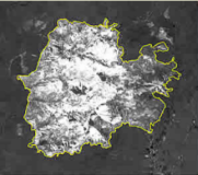
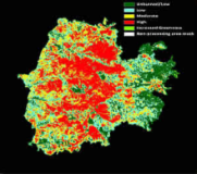 Burn severity layers are thematic images depicting severity as unburned to low, low, moderate, high, and increased greenness (increased postfire vegetation response). The layer may also have a sixth class representing a mask for clouds, shadows, large water bodies, or other features on the landscape that erroneously affect the severity classification.
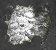 Burned area boundary as detected by using the prefire and postfire images, and the
 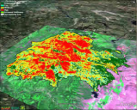 Two visualization products are created for each fire, one in
 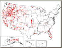 The burned area boundaries dataset is a vector polygon
 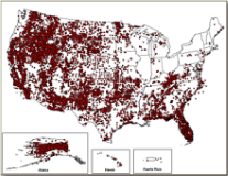 The fire occurrence location dataset is a vector point
 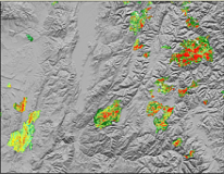 The burn severity mosaics consist of thematic raster images of