QGIS Fire Mapping Tool
The QGIS FMT was developed to address user needs, who wish to determine the effects of small fires that are below the MTBS burned area threshold, or who cannot wait for an MTBS assessment to be published. The tool facilitates the identification and processing of Landsat imagery that correspond to a user-specified area of interest, generates fire perimeters, and performs thresholding of the Landsat imagery to produce burn severity images. Using this tool, users can employ satellite-based imagery and derivative information to produce their own burn severity assessments. QGIS FMT mimics the original EMT developed by GTAC and used by the MTBS team. This tool is fully open-source and is freely distributed. For additional tool support please contact us.
Download Tool & Documentation
This tool was originally developed through funding from the NASA Applied Science Program, grant number NNH12AU71I. NASA provided support for initial development with operational implementation and maintenance now transferred to the MTBS program.
January 2025:
The capability to process and utilize Landsat Collection 2 Level-2 has been added to the updated QGIS FMT.
August 2024:
The QGIS FMT has been updated to work with QGIS 3.x and minor bugs have been addressed. The capability to use Sentinel imagery has been added, so users will have more options when selecting imagery for their mapping projects. The dependency on the USGS’s ESPA system has been removed. Any mappings must be completed using either Sentinel or Landsat imagery and can’t be mixed. The new FMT will only work with QGIS 3.x, so to use the new tool, please update to that version.

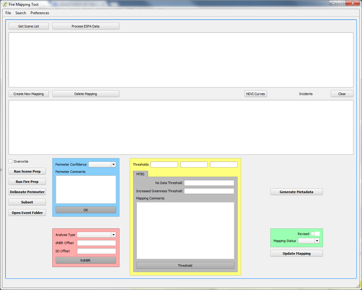
Screenshot of the main user interface of the QGIS FMT.

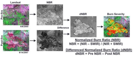
Burn severity mapping process.